GTU Maps Manavgat Fire
August 1, 2021
The areas affected by the recent Manavgat Fire has been mapped using optical and thermal satellite images at the "Advanced Remote Sensing Technology Lab" under the Department of Geomatics Engineering at GTU.
The areas affected by the forest fire that started in the Manavgat District of the City of Antalya, Turkey on 28 July 2021 and led to loss of life and property has been analyzed based on optical and thermal satellite images by Prof. Dr. Taşkın Kavzoğlu, Prof. Dr. Umut Güneş Sefercik, Assoc. Prof. Dr. İsmail Çölkesen and Research Assistant Muhammed Yusuf Öztürk, who are faculty at the Remote Sensing Program, Department of Geomatics Engineering at GTU.
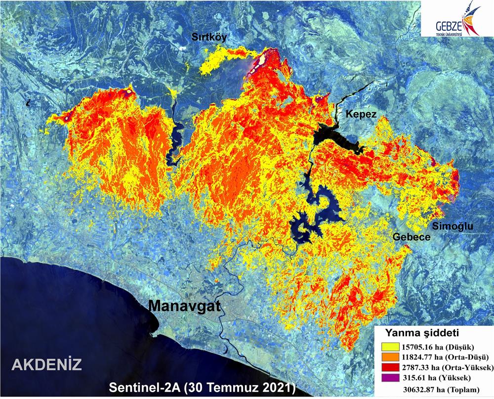
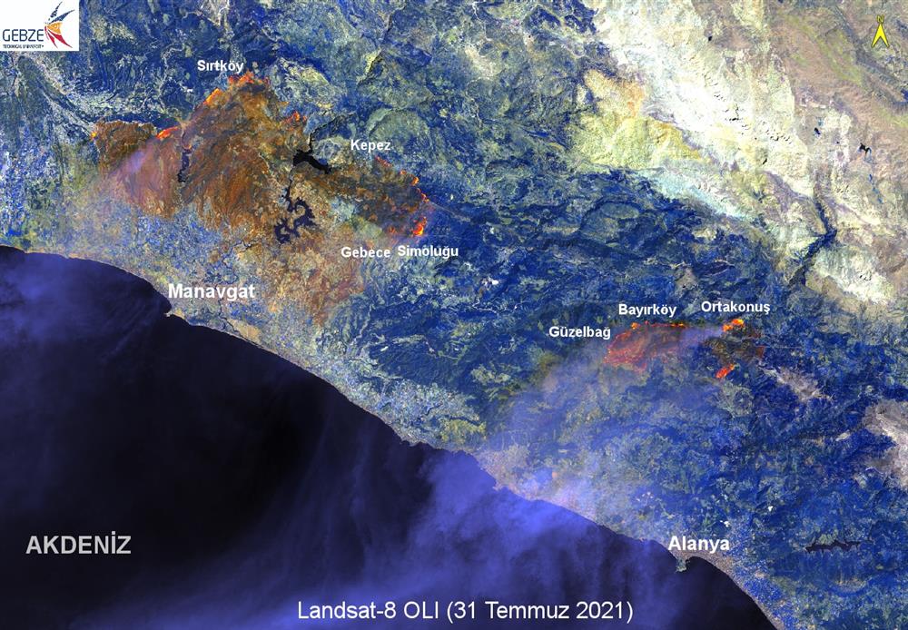
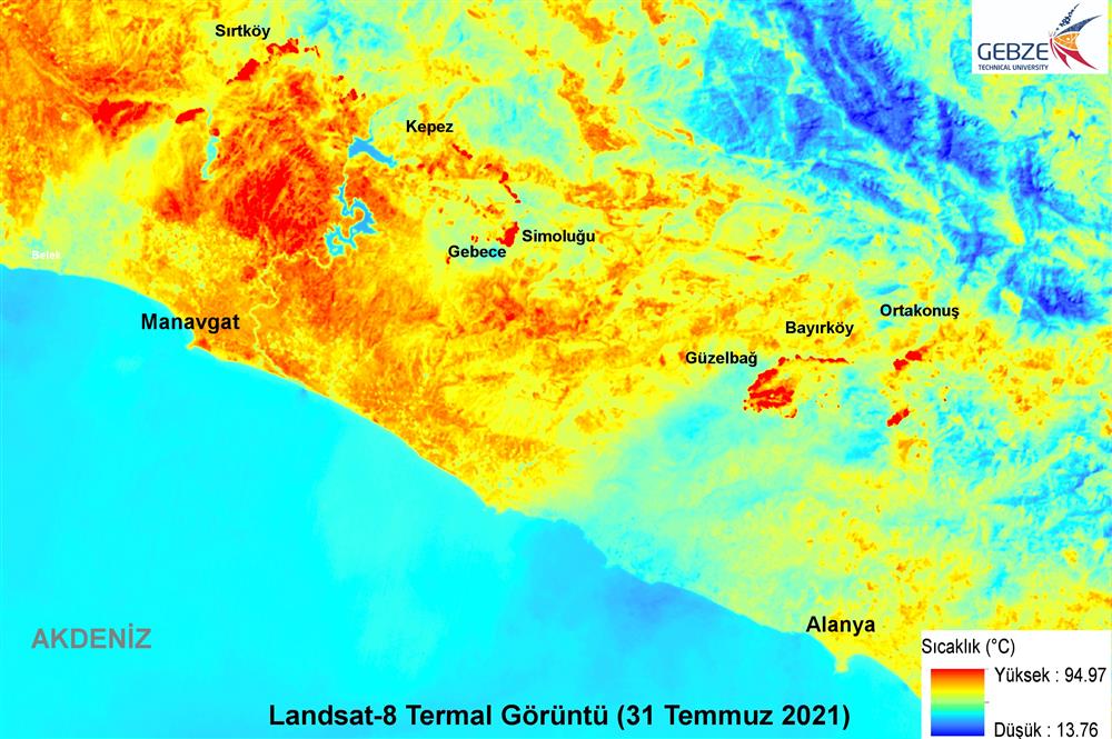
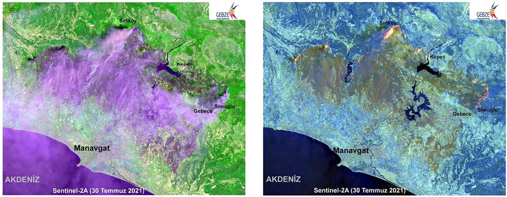
The Landsat-8 OLI satellite images dated 31 July 2021, taken by USGS and the Sentinel-2 satellite images dated 30 July 2021, released by ESA were analyzed using image processing techniques to detect the changes due to the fire in Manavgat, which has been affected the most by the recent forest fires in Turkey. It was determined that the fire had affected 30,632.87-hectare land by 30 July 2021. The satellite images of the affected areas can be seen below.